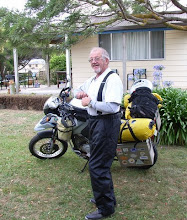
Seattle, Wa- Vancouver, B.C – Haines Junction, Yukon- Tok, Alaska
After spending the weekend in Seattle with dubious friends of questable character.
Monday found myself back on the road going north for the next phase of this trip. Crossing the border and circumventing Vancouver was fairly straightforward. Following Route 99 around the coastline up to Whistler (host for Winter Olympics 2010) was enjoyable as the roads are in excellent condition due to the Winter Olympics scheduled for next year. Once you get beyond Pemberton, the road gets a bit rugged with construction, paving and gravel. But this is where you want to be, away from the glitter, traffic and people. The campsite for the night is in a rest area of sorts, out of the wind and a 5 lb bag of organic tortilla chips to munch on.
Of course I could not pick a spot that had the sun hitting it until1200hrs. It was a bit on the chill side and trying to put on as many layers of clothes as possible inside the sleeping bag is always a fun event. First major stop was for a cuppa plus one to go. Staying on Rt 99 was enjoyable, then we join the masses with another slew of vehicles together on Route 97 going north. We live with Rt 97 allllllllll day long plus at least 12 road construction sites. To top this off just north of Williams Lake we have a 2 car crash, which kills both occupants. It takes the fire department and medics 4 hours to cut the victims out of the wreckage. The vehicle that caused the crash had veered across the centerline in excess of 90 mph.
Hixon is the site for the night and I am now in mosquito country and the fun begins also have made a drastic change to the Goatmobile for sleeping. And is life even better. Still haven’t figured out how to install the beer keg on the roof yet.
Back on Route 97 up to Prince George, probably the largest city in northern British Columbia, then Route 16 west for the next 4 hours. Finally arriving in the town of Kitwanga. From here it is Route 37 north. Now most people with just a half tank of petrol would fill the tank up again with questionable gas stations up the road. Not yours truly though because he is just too smart for his own good. Both gas stations that I was depending on were closed and out of business. The fuel warning light is on and I have another 70 (46 miles) kilometers to go for the nearest petrol station. Stewart, B.C. was the closest and the only saving grace was that it was all down hill into Stewart. After filling ($60.00) up I estimated that I was on fumes for the last mile. And of course there is no cell phone coverage with adds a bit of excitement. Spent the night at a RV site and don’t we have mosquito’s here in big, big numbers. Me thinks this is going to be the norm for the rest of the trip until the east coast, maybe. The RV site had a grizzly come through the camp last week so it is no tents or soft side campers for overnight stays at all.
The trip back out from Stewart on Route 37A is not to be missed. Mountains on both sides of the road and a glacier as an added attraction. And if you have the time and patience, the Salmon Glacier is an hour and a half away via sealed road
Southwest of Stewart through Canadian and US Customs, a bit humbug. Once you are out of Stewart it is route 37 north to Watson Lake, that’s if you get there. Last year about this time I came up this way via the Jasper National Park, Fort Nelson then west through Whitehorse. If I had my choice again, Route 37 would be the way to go, but you would then miss the huge glacier at Jasper along with 50 tour buses and a mass of people. Getting back to Route 37 north, it’s a mixture of sealed road and gravel along with the odd Black Tail Deer and mountain sheep. It’s a long drive but the scenery well makes up for it. The campsite for the night is a rest area just 30k south of Watson Lake.
Had a chance to talk to people from Ontario and their take on crossing from Alberta to Ontario. Flat farmland with roads that run straight and when you get to the horizon the road continues straight till the next horizon, just grin and bear it. A bit like the outback of Australia I would say.
Another night of rain, but as I made a few modifications to the Goatmobile, single nights on the road will be inside the vehicle. It takes about 15 minutes to get everything sorted out and along with the 52 inch HD TV screen, more better!!!
Up to the Great Alaska Highway heading west to Whitehorse, capital of the Yukon Territories, and 5 hours later I am in the city itself. Too busy and too many people so with Haines Junction only another 150 kilometers west and the sun still bright on the horizon, it was a go. Haines Junction, I passed this way last year on my motorcycle, has a German Bakery that is not to be missed. It is fat pill heaven to the max along with a great cuppa of coffee. Haines was supposed to be mosquito’s free but somewhere some how the word just didn’t get out………
Just a short note; total petrol cost for today was $110.00 and the more remote I get, it will get worst. Tomorrow I’ll be in Tok, Alaska then back across the border into the Yukon and the Northwest Territories before heading south into Alberta.
Haines Junction to Tok, Alaska is a mind numbing experience. First you have frost heaves (Google the name for an explanation) then road construction and last of all chip seal roads that are dustier then the whatever’s. Tok is wet, rainy, overcast and no relief insight for better weather. Its ok as I am out of here tomorrow for Chicken, Alaska, ferry across the Yukon River and Dawson City, Yukon for the night.
Facebook for photos
Norm The Greynomad
Saturday, June 27, 2009

Saturday, June 20, 2009
06/20/09 Seattle, Wa-Vancouver Island, British Columbia (BC)-Seattle
After spending a few days in sunny (don’t even believe that one) Seattle, even had to put chains on the Goatmobile, it was buying a bike, getting the tyres rotated and actually sleeping in a bed. Had to pay the lady of the house in cigars though; she then sells the cigar stubby’s to the homeless. Another great idea for the stimulus package coming out of Washington.
Away from Seattle catching the ferry to Bainbridge Island then west to Port Angeles for the ferry to Vancouver Island. Ferry ride was uneventful but getting out of Victoria was a bit of a bear but after making just a few wrong turns the vehicle was finally pointed to route 14 which runs along the south west end of the island. Hoping that I would make it to Port Renfrew, but time was getting short so it was into French Beach Park, a provincial park, for the night and sleeping in the goatmobile
With a Power Bar and a cup of hot chocolate, off to Port Renfrew for another 2 cuppa’s. Just enough to max me out and keep me awake for the next 48 hrs. Port Renfrew north on a logging road that has just been sealed to Mesachie Lake for email and a lot of nonsense. Back to Route 1 and following this north to route 19 before turning off on Route 4 to Tofino. Stopping at an Information booth and the prices just for a tent site in Tofino was $42.00. Decided that the National Park for $23.00 was just a bit better. Did see 2 black bears crossing a creek along side the road though and did manage to get at least one picture.
One thing you will find at both the Provincial and National Parks is no shower facilities. Sooooooooooooooo tomorrow, after going 15 days without a wash it is into Icluelet for a shower ($6.00). And here I thought New Zealand was expensive!!
Forget the wash, forget the cuppa, go to Tofino and turn around. Object today was a campsite in the Strathcona Provincial Park. Getting there was back out to Route 19, head north to Campbell River then west on 28 next south to Ralph River Campsite. Before this we continue on to Myra Falls, which you cannot miss, it is spectacular in every sense of the word. And for those who want to, and I mean want to, jump in the pool. Believe me it will drop the body core temp down quickly.
None of you have met Jill; she is with me every step of the way. She doesn’t argue, give grief for making a wrong turn, mine if I pass gas while driving, have bad breath in the morn, enjoys all of her meals and doesn’t mind me wearing clothes for 5-10 days at a time. She is the female voice on my GPS and I could have chosen John, but more likely he be more humbug and no sense of humour.
Before I get any further if for any reason you are thinking of getting into the outback, you best bring plenty of water or you can just boil as you go (my that is a catchy phase).
Over to Gold River and a stop at the local Wi-Fi coffee shop where I got the latest on where to go for the day. Logging road out to Tahsis for a spin and another cuppa. Road was in decent shape, primarily gravel with patches of seal. I would venture to say that the tide fluctuation at Tahsis must be 10-12 feet. After this I am heading back east until I caught the road to Tuta Marina, Tlupana Inlet. This is definitely a logging road, rough gravel and you best have a good set of tyres on, as this road will make a believer out of you. Of course you have been eating gravel dust all morning so another 50 (30 miles) kilometers of dust just adds to the excitement. Got down to Tuta Marina and immediately you are looking for a way out. A bit short on the setup and outhouse facilities. So back up the road to Cougar Creek RV park and being that I am a senior it was $5.00 for the night.
Up bright and early and the no-see-ems (black flies) are waiting right outside the tent. So moving quickly and trying to minimize the biting activity we are on our way back to Gold River Coffee Shop and a major fat pill purchase. After talking to the locals it was Telegraph Cove for today’s event. Back out to Campbell River then north on route 19 and believe me when I say the amount of cars on the road are few and far between. The cost of petrol is at right over $4.00 a gallon (Canada) and has turned out to be a major expense for this trip. The US is still sitting at $2.69 in Washington State.
Weather is going to turn nasty within the next day or two up in Northern Vancouver Island. The Goatmobile will just have to suffer with the 10 day socks hanging from the windows.
Telegraph Cove it is for the night, other then being a tourist trap, nothing special about the place. As it is along the shoreline we have the whale watcher, scuba, kayak and spend your money as you please. Other then not having to pay for the shower, the campsite could take a huge miss. Cape Scott was the calling for the next days adventure.
Getting to Cape Scott was 40 miles of gravel road via the booming metropolis of Holberg. Holberg’s existence is mainly supportive of the logging industry, 200 men with 5 women in the township. Cape Scott is a hiker’s dream; you park your vehicle then walk 15 kilometers to ocean. Next follow the shoreline east for 25 kilo’s and have the water taxi pick you up for the return trip. What you pack in is what you pack out with. The Cape is a wilderness area; nothing is available except for the golden arches……… After getting out to the Cape and was it raining, thoughts of a drier environment was on the agenda. Back to Port Hardy for the night, hot shower and the wet weather following me. Wet tent in the morn but what was new.
Campbell River and Loveland Bay Provincial Park for the night with a stop at Port Alice. Port Alice as well as all of the other logging towns are in dire straits due to the down turn in the economy and the collapse of the logging industry. Back to Loveland, it started raining and all night long it was beating a pattern on the Goatmobiles roof.
As I had scheduled a ferry from Sidney, B.C. to Anacortes, Wa for Thursday morning, moving down closer to Victoria was a must. Tried staying off the main road as much as possible as time was not a factor. Finally arrived at Bamberton Provincial Park, 45 kilometers north of Victoria and $15.00 for the night. Forgot to mentioned that when I pulled into Campbell River for petrol, to fill the 15-gallon tank I was out of pocket $47.00 Canadian dollars, bloody hell.
I’ve had such good luck with the Provincial Parks in British Columbia that my trip across Canada will be guided as much as possible as to the locations of the parks.
Met a couple from Manitoba and we got into a conversation about mosquitoes. Well it seems that Manitoba is considered the mosquito capital of Canada along with the black “No-see-ems” flies. Matter of fact as long as I stay as far north as I plan to every bit of kit that I’ll be wearing will have the seal of approval of Duct Tape.
So the ferry it was from Sidney, B.C to Anacortes, Washington. Got in around 1500hrs then off to Deception Pass State Park for the night. Being the bright lad that I am my campsite is directly across the way from a high school birthday party……….me thinks that I plan these confrontations with kids just knowing that it is improving my sensitivity training. Tomorrow back down to Seattle for a day or two waiting on my current vehicle registration to be forwarded from Hawaii.
There are photos and a map of Vancouver Island track posted on Facebook.
enjoy...
Norm
The Greynomad
Away from Seattle catching the ferry to Bainbridge Island then west to Port Angeles for the ferry to Vancouver Island. Ferry ride was uneventful but getting out of Victoria was a bit of a bear but after making just a few wrong turns the vehicle was finally pointed to route 14 which runs along the south west end of the island. Hoping that I would make it to Port Renfrew, but time was getting short so it was into French Beach Park, a provincial park, for the night and sleeping in the goatmobile
With a Power Bar and a cup of hot chocolate, off to Port Renfrew for another 2 cuppa’s. Just enough to max me out and keep me awake for the next 48 hrs. Port Renfrew north on a logging road that has just been sealed to Mesachie Lake for email and a lot of nonsense. Back to Route 1 and following this north to route 19 before turning off on Route 4 to Tofino. Stopping at an Information booth and the prices just for a tent site in Tofino was $42.00. Decided that the National Park for $23.00 was just a bit better. Did see 2 black bears crossing a creek along side the road though and did manage to get at least one picture.
One thing you will find at both the Provincial and National Parks is no shower facilities. Sooooooooooooooo tomorrow, after going 15 days without a wash it is into Icluelet for a shower ($6.00). And here I thought New Zealand was expensive!!
Forget the wash, forget the cuppa, go to Tofino and turn around. Object today was a campsite in the Strathcona Provincial Park. Getting there was back out to Route 19, head north to Campbell River then west on 28 next south to Ralph River Campsite. Before this we continue on to Myra Falls, which you cannot miss, it is spectacular in every sense of the word. And for those who want to, and I mean want to, jump in the pool. Believe me it will drop the body core temp down quickly.
None of you have met Jill; she is with me every step of the way. She doesn’t argue, give grief for making a wrong turn, mine if I pass gas while driving, have bad breath in the morn, enjoys all of her meals and doesn’t mind me wearing clothes for 5-10 days at a time. She is the female voice on my GPS and I could have chosen John, but more likely he be more humbug and no sense of humour.
Before I get any further if for any reason you are thinking of getting into the outback, you best bring plenty of water or you can just boil as you go (my that is a catchy phase).
Over to Gold River and a stop at the local Wi-Fi coffee shop where I got the latest on where to go for the day. Logging road out to Tahsis for a spin and another cuppa. Road was in decent shape, primarily gravel with patches of seal. I would venture to say that the tide fluctuation at Tahsis must be 10-12 feet. After this I am heading back east until I caught the road to Tuta Marina, Tlupana Inlet. This is definitely a logging road, rough gravel and you best have a good set of tyres on, as this road will make a believer out of you. Of course you have been eating gravel dust all morning so another 50 (30 miles) kilometers of dust just adds to the excitement. Got down to Tuta Marina and immediately you are looking for a way out. A bit short on the setup and outhouse facilities. So back up the road to Cougar Creek RV park and being that I am a senior it was $5.00 for the night.
Up bright and early and the no-see-ems (black flies) are waiting right outside the tent. So moving quickly and trying to minimize the biting activity we are on our way back to Gold River Coffee Shop and a major fat pill purchase. After talking to the locals it was Telegraph Cove for today’s event. Back out to Campbell River then north on route 19 and believe me when I say the amount of cars on the road are few and far between. The cost of petrol is at right over $4.00 a gallon (Canada) and has turned out to be a major expense for this trip. The US is still sitting at $2.69 in Washington State.
Weather is going to turn nasty within the next day or two up in Northern Vancouver Island. The Goatmobile will just have to suffer with the 10 day socks hanging from the windows.
Telegraph Cove it is for the night, other then being a tourist trap, nothing special about the place. As it is along the shoreline we have the whale watcher, scuba, kayak and spend your money as you please. Other then not having to pay for the shower, the campsite could take a huge miss. Cape Scott was the calling for the next days adventure.
Getting to Cape Scott was 40 miles of gravel road via the booming metropolis of Holberg. Holberg’s existence is mainly supportive of the logging industry, 200 men with 5 women in the township. Cape Scott is a hiker’s dream; you park your vehicle then walk 15 kilometers to ocean. Next follow the shoreline east for 25 kilo’s and have the water taxi pick you up for the return trip. What you pack in is what you pack out with. The Cape is a wilderness area; nothing is available except for the golden arches……… After getting out to the Cape and was it raining, thoughts of a drier environment was on the agenda. Back to Port Hardy for the night, hot shower and the wet weather following me. Wet tent in the morn but what was new.
Campbell River and Loveland Bay Provincial Park for the night with a stop at Port Alice. Port Alice as well as all of the other logging towns are in dire straits due to the down turn in the economy and the collapse of the logging industry. Back to Loveland, it started raining and all night long it was beating a pattern on the Goatmobiles roof.
As I had scheduled a ferry from Sidney, B.C. to Anacortes, Wa for Thursday morning, moving down closer to Victoria was a must. Tried staying off the main road as much as possible as time was not a factor. Finally arrived at Bamberton Provincial Park, 45 kilometers north of Victoria and $15.00 for the night. Forgot to mentioned that when I pulled into Campbell River for petrol, to fill the 15-gallon tank I was out of pocket $47.00 Canadian dollars, bloody hell.
I’ve had such good luck with the Provincial Parks in British Columbia that my trip across Canada will be guided as much as possible as to the locations of the parks.
Met a couple from Manitoba and we got into a conversation about mosquitoes. Well it seems that Manitoba is considered the mosquito capital of Canada along with the black “No-see-ems” flies. Matter of fact as long as I stay as far north as I plan to every bit of kit that I’ll be wearing will have the seal of approval of Duct Tape.
So the ferry it was from Sidney, B.C to Anacortes, Washington. Got in around 1500hrs then off to Deception Pass State Park for the night. Being the bright lad that I am my campsite is directly across the way from a high school birthday party……….me thinks that I plan these confrontations with kids just knowing that it is improving my sensitivity training. Tomorrow back down to Seattle for a day or two waiting on my current vehicle registration to be forwarded from Hawaii.
There are photos and a map of Vancouver Island track posted on Facebook.
enjoy...
Norm
The Greynomad
Monday, June 8, 2009
06/08/09 Castle Rock - Westport-Port Angeles-Bainbridge Island-Seattle
Castle Rock- Westport-Port Angeles-Bainbridge Island-Seattle
With the wind in my sails, same socks for day 5 and the likely hood that I have another 2 weeks to go before changing same, does life really get any better…
South to the Columbia River then its west to the coast with a short trip to Leadbetter Point. Believe me it is not a short trip and the toilet paper was missing out of the loo when I got there. How do you figure…? Turned around and back down to Rt 101 then stopping at the Willapa National Wildlife Refuge where I quietly informed them of the toilet paper issue…….
From Willapa, it was pretty much following the coastline into Westport for the next two days.
It was Westport and 200 miles on the odometer for the day of going there and here and not really anywhere. Made it up to Taholah, Quinault Indian Reservation for a bit. If you have ever been to a native tribe area be it New Zealand, Australia, Canada or the US then I need say no more. Of course the high number of diabetics in the community is a given.
Westport in the rear view mirror and new horizons for the day. Followed Route 101 up the coast and it wasn’t until Rt 101 got into the Olympic National Park did the scenery begin to really get interesting. Pulling into the beaches and looking at the amount of driftwood along the frontage and watching the fog play with the weather. As much as I enjoyed the Oregon coast, the Washington coast has a beauty of its own that really appeals to me. Another downside of the Oregon coast is the amount of commercialization that is going on.
Port Angeles RV site is it for the next couple of days as I wander both west and east.
West it is to Cape Flattery for the day. Petrol prices in the outer back at the $2.97 level and tell me if we don’t see $4.00 level before this coming fall. Getting to Cape Flattery via Route 112 will have you pissing up a rope by the time you get there. Not only is the road all over the place with curves that will drive you nuts, but we also have road construction, which adds another hour onto our travels. And to add to the excitement of traveling in either direction we have the 30 and under trying to set speed records going around blind curves. But it is ok, we need to have a better selection of the gene pool and these clowns are going to provide that necessary data one of these days.
The Cape is worth the drive and besides the $10.00 you pay to the local Indian tribe to visit same the view is worth every penny. And to add enjoyment to the Cape we have 3 buses of teenagers from the Port Angeles high school out there today on a field trip. No comment on the dress code!
Dungeness NWR and Hurricane Ridge was next on the agenda for the following day. The NWR covers a long spit jutting out into the ocean, which you can walk at low tide, recommended, and enjoy the wildlife while all the time looking for that odd glass ball……………….
Hurricane Ridge, Olympic National Park (NP) is up at the 5500-foot level and I WAS GURANNTEED THAT there were wild flowers there. The flowers were there all right, if you don’t mind waiting for the 3 ft of snow to melt.
It was time to move on to the big island of Bainbridge and with the Hood Canal Bridge having just opened a day before, what was a 5-hour trip now became 1 ½ hrs. Spent 2 days in Bainbridge and was given the guided tour of every beach, pizza joint, loo and houses for sale that were over a million in price. Acquired not only a wet tent but also every slug that could manage to creep under the tent. I just happen to hit Bainbridge when they were having a heat wave, 60 degrees, give me a break but the locals were adamant about this. Me thinks someone is sniffing some old cans of paint.
Seattle it is for the next day or two getting me supply of power bars in stock, tires rotated on the Goatmobile, purchase a bike rack for the back of the Honda and a very, very cheap pedal bike.
Facebook is a source of the latest pictures, enjoy.
Norm
The Greynomad
With the wind in my sails, same socks for day 5 and the likely hood that I have another 2 weeks to go before changing same, does life really get any better…
South to the Columbia River then its west to the coast with a short trip to Leadbetter Point. Believe me it is not a short trip and the toilet paper was missing out of the loo when I got there. How do you figure…? Turned around and back down to Rt 101 then stopping at the Willapa National Wildlife Refuge where I quietly informed them of the toilet paper issue…….
From Willapa, it was pretty much following the coastline into Westport for the next two days.
It was Westport and 200 miles on the odometer for the day of going there and here and not really anywhere. Made it up to Taholah, Quinault Indian Reservation for a bit. If you have ever been to a native tribe area be it New Zealand, Australia, Canada or the US then I need say no more. Of course the high number of diabetics in the community is a given.
Westport in the rear view mirror and new horizons for the day. Followed Route 101 up the coast and it wasn’t until Rt 101 got into the Olympic National Park did the scenery begin to really get interesting. Pulling into the beaches and looking at the amount of driftwood along the frontage and watching the fog play with the weather. As much as I enjoyed the Oregon coast, the Washington coast has a beauty of its own that really appeals to me. Another downside of the Oregon coast is the amount of commercialization that is going on.
Port Angeles RV site is it for the next couple of days as I wander both west and east.
West it is to Cape Flattery for the day. Petrol prices in the outer back at the $2.97 level and tell me if we don’t see $4.00 level before this coming fall. Getting to Cape Flattery via Route 112 will have you pissing up a rope by the time you get there. Not only is the road all over the place with curves that will drive you nuts, but we also have road construction, which adds another hour onto our travels. And to add to the excitement of traveling in either direction we have the 30 and under trying to set speed records going around blind curves. But it is ok, we need to have a better selection of the gene pool and these clowns are going to provide that necessary data one of these days.
The Cape is worth the drive and besides the $10.00 you pay to the local Indian tribe to visit same the view is worth every penny. And to add enjoyment to the Cape we have 3 buses of teenagers from the Port Angeles high school out there today on a field trip. No comment on the dress code!
Dungeness NWR and Hurricane Ridge was next on the agenda for the following day. The NWR covers a long spit jutting out into the ocean, which you can walk at low tide, recommended, and enjoy the wildlife while all the time looking for that odd glass ball……………….
Hurricane Ridge, Olympic National Park (NP) is up at the 5500-foot level and I WAS GURANNTEED THAT there were wild flowers there. The flowers were there all right, if you don’t mind waiting for the 3 ft of snow to melt.
It was time to move on to the big island of Bainbridge and with the Hood Canal Bridge having just opened a day before, what was a 5-hour trip now became 1 ½ hrs. Spent 2 days in Bainbridge and was given the guided tour of every beach, pizza joint, loo and houses for sale that were over a million in price. Acquired not only a wet tent but also every slug that could manage to creep under the tent. I just happen to hit Bainbridge when they were having a heat wave, 60 degrees, give me a break but the locals were adamant about this. Me thinks someone is sniffing some old cans of paint.
Seattle it is for the next day or two getting me supply of power bars in stock, tires rotated on the Goatmobile, purchase a bike rack for the back of the Honda and a very, very cheap pedal bike.
Facebook is a source of the latest pictures, enjoy.
Norm
The Greynomad
Monday, June 1, 2009
01/06/09 Florence-Columbia River-Mt Hood, Oregon-Toppenish-Mt Rainer-Mossyrock-Mount St Helens, Washington
1 June 2009
Florence-Columbia River-Mt Hood, Oregon-Toppenish-Mt Rainer-Mossyrock-Mount St Helens, Washington
Out of Florence with a coyote crossing my path, turning north for new roads, people and sleepless nights. Followed the coast line (Rt 101) and looking for that first cuppa to really start the day off right. Off Depoe Bay, stopping to take a picture of the coast line when I spotted a green 4x4 moving along the beach. The vehicle stopped right below me (200 ft up), individual got out of the truck and walked over to a seal, clearly out weighting the man by 100lbs. It was obvious that the seal was dead as there was no reaction from the seal at all. In most probability, someone had spotted the seal earlier and called it in.
Made numerous stops at National Wildlife Refuge's as I traveled North, some were open to the public others not.
Reached the township of Seaside and found a RV site for the night. As it was raining, the Goatmobile was the sanctuary for the night. A bit cramped and again realizing that I bought too much gear. Give myself another month or so and the popcorn machine with the TV screen will just have to go.
The Lewis and Clark Trail and the Columbia River was the quest for the day. For those that are not in the know, Lewis and Clark were a couple of hippies out of St Louis, Missouri that were into heavy metal and hip-hop music. To make a long story short, they bought a Cadillac Escalade, the biggest SUV around, and another fine product from General Motors. Off they went north following the Missouri River north-west, selling flowers and that funny weed that everyone smokes, when they met Bin Lama, who in turn sold them the Columbia River for a stake in the Chrysler Corp. Of course with a great return on a sub-prime loan. Any questions see my accountant.
After taking the by-pass through Portland, Oregon, which was a bloody nightmare, continued east along the Columbia. If you can do it follow route 30 vice the Interstate 84, it’s a big slow but all of the water falls, gorges, camp sites and dams are accessible through Rt 30. There is nowhere to stop on Rt 84 and you lose a lot of the beauty of the Columbia River Gorge. I got off the Hood River exit and traveled north to Mount Hood then east to Dufur (pop 650) for a night stay at the city park
Stopping for that morning cuppa at the local store then it was back down from Dufur to The Dalles along the Columbia River east. Again running the interstate but if I could find a county road then so be it. Once you get beyond Rufus, it is a very long ride until the next bridge to Washington State as the Oregon side of the river gets pretty humbug. Crossed over at Umatilla into Washington State and headed west again along the Washington side of the river. Actually enjoyed the ride more as it was a 2-lane road with the ability to get off when I wanted to. At Maryhill decided that Rt 97 was the way to go and having decided at staying at a RV site in Toppenish.
Stopped briefly at the Toppenish NWR but it was closed up so it was to the Yakama Nation RV site for the night. Had the tent area to myself until a bus load, do you even have to guess, of 4th graders on a field trip parked themselves right next to me. The kids were well behaved and one lad decided that he was going to bring me up to speed on global warming.
Global warning has not, and I can verify this with pictures of my windscreen that there has been a decrease in the influx of bugs.
Toppenish to Mossyrock was on for the agenda via Mt Rainer. Unfortunately the rangers and Rainer had plans other wise. Rainer had only one campsite open and that didn’t happen until this past Memorial Day holiday. All of the other campsites are still covered with snow and debris. A major road through Mt Rainer got completely washed out and will not be open until August time frame. Since I was on my third cuppa, decide to circumvent Rainer and add another 100 miles to the odometer. Got loss a few times but what is new……..
Now the only place to find lodging in Mossyrock was the state park. If you have never experienced a state park before, do it once and you will never go back. The state park might be a bit cheaper but believe me when it comes to peace and quite a RV site is more better believe me. If I had my way that night there would have been body bags lining the entrance to the state park. Parents just seem to walk in the other direction when their precious little ………….start causing problems, matter of fact the parents would be in the same body bag with their kid.
Mount St Helens was the quest for the day and the next. You drive up, take pictures and drive down and that’s it. Not to be missed if you are in the area though and the roads and information centers are excellent. Now the south side of St Helens is a different animal altogether. Snow is still in abundance and just about all of the access roads are closed. Made numerous attempts going up roads that were closed but it all came back to snow. Did meet one individual who had a flat tire, no tire iron, no truck jack and last of all no cell phone coverage. Stopped and offered assistance but the tools I have just does not fit a ¾ ton truck. Luckily someone was along within minutes; this guy had everything but the kitchen sink. With the 3 of us working together, we had the tyre changed and away within 30 minutes.
Next port of call is Westport, just about a 1/3 of the way up the Washington State coastline.
Go to Facebook for the latest pictures.
I’ve decided to do my part for global warming and minimize my carbon footprint. Resorting to my motorcycle days, we do the sniff test on a bi-weekly event. This way I can wear the same clothes for a minimum of 2 weeks, showers included and save all of the wasted water resources. I need a list of volunteers that will start this movement; a family in the southeast corner of Oregon have already applauded this concept especially the husband of this household.
Norm
The Greynomad
Florence-Columbia River-Mt Hood, Oregon-Toppenish-Mt Rainer-Mossyrock-Mount St Helens, Washington
Out of Florence with a coyote crossing my path, turning north for new roads, people and sleepless nights. Followed the coast line (Rt 101) and looking for that first cuppa to really start the day off right. Off Depoe Bay, stopping to take a picture of the coast line when I spotted a green 4x4 moving along the beach. The vehicle stopped right below me (200 ft up), individual got out of the truck and walked over to a seal, clearly out weighting the man by 100lbs. It was obvious that the seal was dead as there was no reaction from the seal at all. In most probability, someone had spotted the seal earlier and called it in.
Made numerous stops at National Wildlife Refuge's as I traveled North, some were open to the public others not.
Reached the township of Seaside and found a RV site for the night. As it was raining, the Goatmobile was the sanctuary for the night. A bit cramped and again realizing that I bought too much gear. Give myself another month or so and the popcorn machine with the TV screen will just have to go.
The Lewis and Clark Trail and the Columbia River was the quest for the day. For those that are not in the know, Lewis and Clark were a couple of hippies out of St Louis, Missouri that were into heavy metal and hip-hop music. To make a long story short, they bought a Cadillac Escalade, the biggest SUV around, and another fine product from General Motors. Off they went north following the Missouri River north-west, selling flowers and that funny weed that everyone smokes, when they met Bin Lama, who in turn sold them the Columbia River for a stake in the Chrysler Corp. Of course with a great return on a sub-prime loan. Any questions see my accountant.
After taking the by-pass through Portland, Oregon, which was a bloody nightmare, continued east along the Columbia. If you can do it follow route 30 vice the Interstate 84, it’s a big slow but all of the water falls, gorges, camp sites and dams are accessible through Rt 30. There is nowhere to stop on Rt 84 and you lose a lot of the beauty of the Columbia River Gorge. I got off the Hood River exit and traveled north to Mount Hood then east to Dufur (pop 650) for a night stay at the city park
Stopping for that morning cuppa at the local store then it was back down from Dufur to The Dalles along the Columbia River east. Again running the interstate but if I could find a county road then so be it. Once you get beyond Rufus, it is a very long ride until the next bridge to Washington State as the Oregon side of the river gets pretty humbug. Crossed over at Umatilla into Washington State and headed west again along the Washington side of the river. Actually enjoyed the ride more as it was a 2-lane road with the ability to get off when I wanted to. At Maryhill decided that Rt 97 was the way to go and having decided at staying at a RV site in Toppenish.
Stopped briefly at the Toppenish NWR but it was closed up so it was to the Yakama Nation RV site for the night. Had the tent area to myself until a bus load, do you even have to guess, of 4th graders on a field trip parked themselves right next to me. The kids were well behaved and one lad decided that he was going to bring me up to speed on global warming.
Global warning has not, and I can verify this with pictures of my windscreen that there has been a decrease in the influx of bugs.
Toppenish to Mossyrock was on for the agenda via Mt Rainer. Unfortunately the rangers and Rainer had plans other wise. Rainer had only one campsite open and that didn’t happen until this past Memorial Day holiday. All of the other campsites are still covered with snow and debris. A major road through Mt Rainer got completely washed out and will not be open until August time frame. Since I was on my third cuppa, decide to circumvent Rainer and add another 100 miles to the odometer. Got loss a few times but what is new……..
Now the only place to find lodging in Mossyrock was the state park. If you have never experienced a state park before, do it once and you will never go back. The state park might be a bit cheaper but believe me when it comes to peace and quite a RV site is more better believe me. If I had my way that night there would have been body bags lining the entrance to the state park. Parents just seem to walk in the other direction when their precious little ………….start causing problems, matter of fact the parents would be in the same body bag with their kid.
Mount St Helens was the quest for the day and the next. You drive up, take pictures and drive down and that’s it. Not to be missed if you are in the area though and the roads and information centers are excellent. Now the south side of St Helens is a different animal altogether. Snow is still in abundance and just about all of the access roads are closed. Made numerous attempts going up roads that were closed but it all came back to snow. Did meet one individual who had a flat tire, no tire iron, no truck jack and last of all no cell phone coverage. Stopped and offered assistance but the tools I have just does not fit a ¾ ton truck. Luckily someone was along within minutes; this guy had everything but the kitchen sink. With the 3 of us working together, we had the tyre changed and away within 30 minutes.
Next port of call is Westport, just about a 1/3 of the way up the Washington State coastline.
Go to Facebook for the latest pictures.
I’ve decided to do my part for global warming and minimize my carbon footprint. Resorting to my motorcycle days, we do the sniff test on a bi-weekly event. This way I can wear the same clothes for a minimum of 2 weeks, showers included and save all of the wasted water resources. I need a list of volunteers that will start this movement; a family in the southeast corner of Oregon have already applauded this concept especially the husband of this household.
Norm
The Greynomad
Subscribe to:
Posts (Atom)